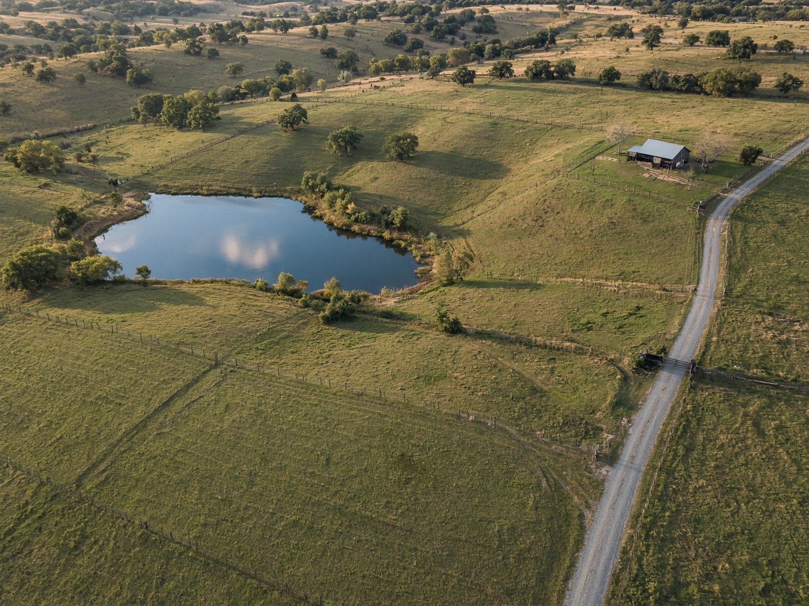
Acreage does not show from the street. Fence lines, ponds, tree cover, and the access road only make sense from above — which is why land listings in North Texas close faster with a drone still.
SkyBird Aerial photographs ranch tracts, development pads, and rural listings from Collin and Denton county horse country to Tarrant and Dallas infill dirt. The job is readability: a buyer should see the water, the road, and the corners without a survey overlay.
We fly high enough to hold the whole tract and low enough that a pond or barn is still a photograph, not a smudge. Print-resolution files are available when the packet goes to a land broker or a family office.
If the property sits near DFW Class B or a smaller airport, we check LAANC during the brief and only schedule when authorization is in place.
- Fence lines, ponds, and access in one frame
- Ranch, tract, and future-pad stills
- Print-resolution files on request
- Licensed flights near DFW airspace
Serving Collin, Denton, Dallas, and Tarrant counties. See coverage.